1. Improve Monitoring Accuracy and Coverage
Ground-penetrating radar and remote sensing technology: The report points out that geological conditions are one of the causes of landslides. In the future, the application of ground-penetrating radar in maintenance and inspection technologies can be strengthened to achieve millimeter-level monitoring of geological structures and deformations, providing early warnings of potential risks.
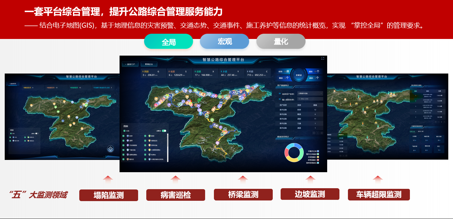
Bridge, tunnel, and slope monitoring optimization: Combining AI video monitoring, radar, and sensors to build a comprehensive, three-dimensional structural safety monitoring system, covering key areas such as slopes, bridges, and tunnels.
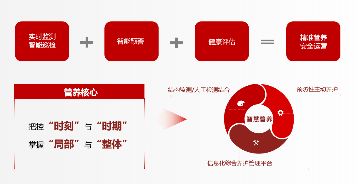
Artificial intelligence data analysis: Utilizing AI algorithms to perform real-time analysis of daily road maintenance and inspection monitoring data, identifying abnormal patterns, and improving the accuracy and timeliness of early warnings.
2. Build an intelligent early warning platform
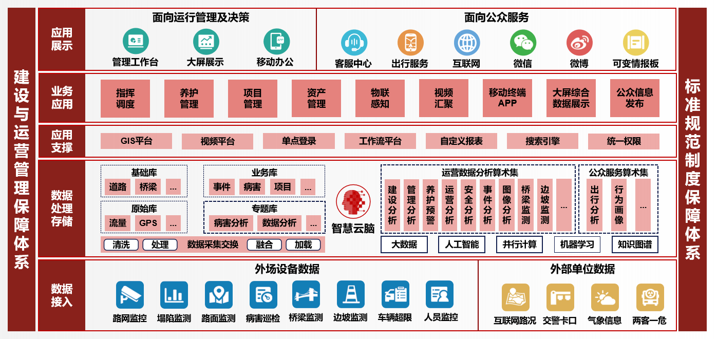
Multi-source data fusion: Integrating data from multiple departments such as meteorology, geology, and transportation to break down information silos and build a unified highway safety early warning platform.
Visualized early warning system: Utilizing technologies such as GIS and BIM to intuitively display monitoring data and early warning information, facilitating rapid decision-making and emergency response by management personnel.
Automated Emergency Response: Enables automatic push notifications of early warning information, automatic activation of emergency plans, and automatic allocation of emergency resources, improving emergency response efficiency.
3. Strengthen System Operation and Maintenance and Talent Training
Regular Maintenance and Upgrades: Establish a comprehensive monitoring system operation and maintenance mechanism, regularly perform equipment maintenance, data calibration, and system upgrades to ensure long-term stable system operation.
Professional Talent Training: Strengthen talent training in monitoring technology, data analysis, and emergency management to provide talent support for safe highway operation.
4. Explore New Technology Applications
5G and IoT: Utilize the high speed and low latency of 5G to achieve real-time transmission of monitoring data and remote control of equipment, improving monitoring efficiency.
BeiDou High-Precision Positioning: Utilize the high-precision positioning function of the BeiDou system to achieve accurate monitoring of slope displacement and bridge deformation.
Digital Twin Technology: Construct digital twin models of highways to simulate structural responses under different working conditions, providing a scientific basis for safety assessment and early warning.


 2025-02-12 14:23:00
  times
times