


Integrated Transportation Meteorological Early Warning and Monitoring System
 |
System Introduction |
The integrated traffic meteorological early warning and monitoring system is built upon GIS geographic information and meteorological big data. Based on data collected from highway meteorological stations, road surface conditions, and equipment status, and relying on big data from meteorological departments, it combines road segment heat map data analysis to provide highway managers with minute-level and kilometer-level near-term weather forecasts, comprehensive disaster information early warnings, trend forecasts, and quantifiable, precise data to provide decision-making support for traffic control. This enables comprehensive monitoring and dynamic management of highway meteorology, allowing for the advance deployment of response strategies, reducing highway accident rates, and improving highway utilization efficiency and economic benefits.
| |
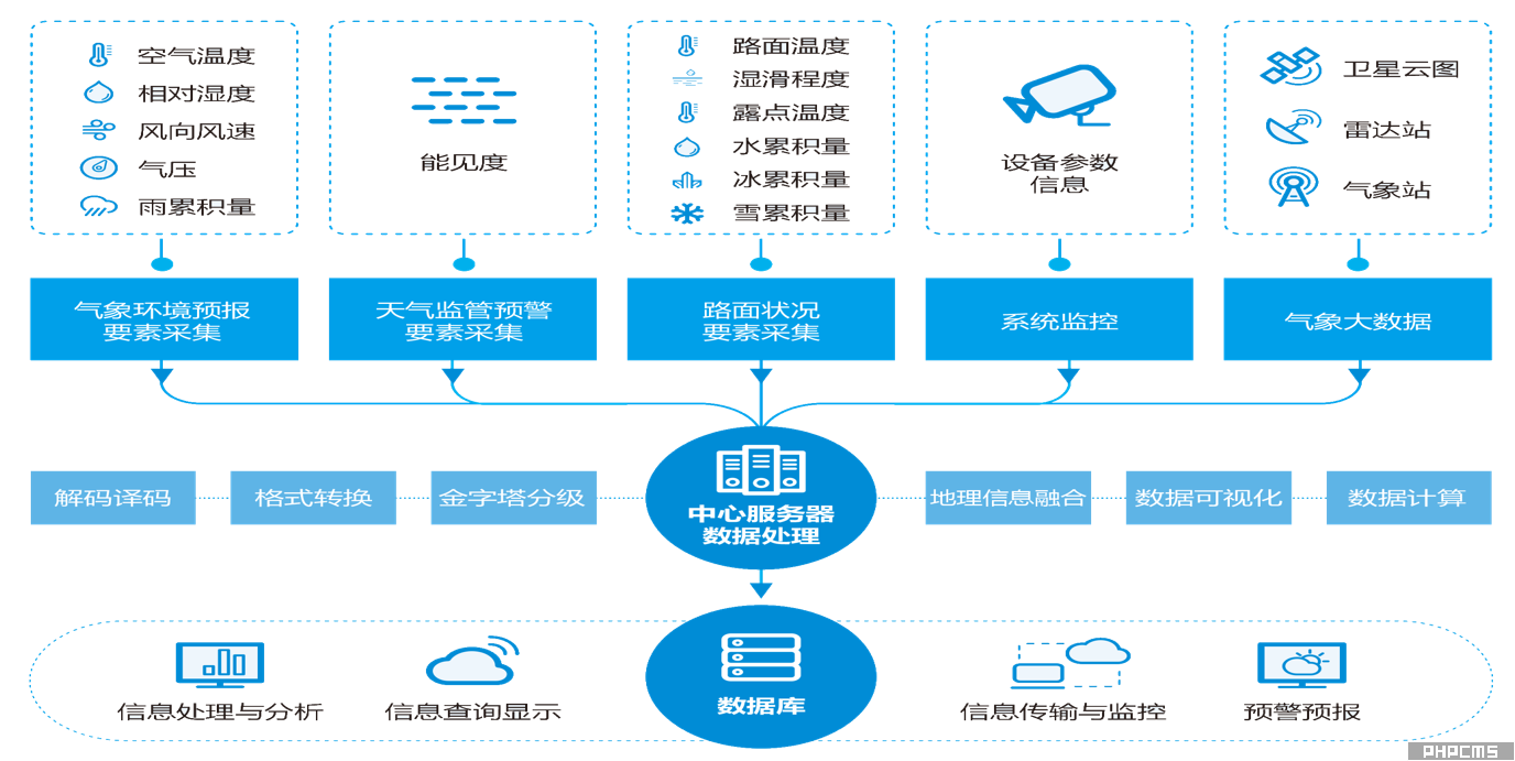
System Composition |
The traffic weather warning and forecasting system consists of three parts: meteorological observation stations, a traffic weather warning and forecasting data model, and a data analysis and traffic weather forecasting data service platform. The meteorological observation stations provide real-time basic meteorological data, including air temperature and humidity, road surface conditions, road surface temperature, and visibility. The data analysis software integrates and accesses thermal map data, meteorological observation station data, and local weather forecast data to calculate and output road icing conditions, meteorological disaster information, etc., providing real-time analysis data and forecasts for the next period, and pushing this data to users.
